2005
TR0132 : Pumping Station between Hamstreet and Ruckinge
taken 19 years ago, near to Ruckinge, Kent, England
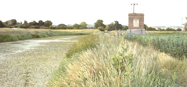
Pumping Station between Hamstreet and Ruckinge
This pumping station is the only building in this grid square. The footpath along the Royal Military Canal runs for 28 miles and this hard-surfaced section between Hamstreet and Ruckinge is particularly pleasant. See Link (Archive Link ) to walk it or Link (Archive Link ) to cycle it.
 Map © Crown Copyright")
TIP: Click the map for more Large scale mapping
- Grid Square
- TR0132, 36 images (more nearby 🔍)
- Photographer
- Adam Colton (more nearby)
- Date Taken
- Wednesday, 6 July, 2005 (more nearby)
- Submitted
- Wednesday, 6 July, 2005
- Subject Location
-
OSGB36:
 TR 0159 3290 [10m precision]
WGS84: 51:3.6023N 0:52.5242E - Camera Location
-
OSGB36: TR 0151 3287
- View Direction
- East-northeast (about 67 degrees)