2005
TR0233 : Royal Military Canal, Ruckinge
taken 19 years ago, near to Ruckinge, Kent, England
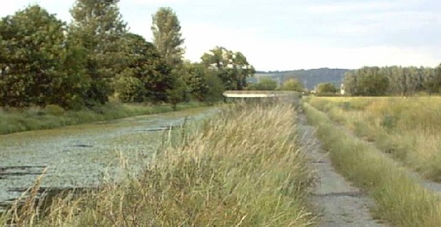
Royal Military Canal, Ruckinge
This view is facing east towards Ruckinge canal bridge. The canal was constructed as a defensive barrier to a feared attack from Napoleon. The footpath alongside it runs for 28 miles and you can find out how to walk this section from Ruckinge to Hamstreet at Link (Archive Link )
 Map © Crown Copyright")
TIP: Click the map for more Large scale mapping
- Grid Square
- TR0233, 110 images (more nearby 🔍)
- Photographer
- Adam Colton (more nearby)
- Date Taken
- Wednesday, 6 July, 2005 (more nearby)
- Submitted
- Wednesday, 6 July, 2005
- Subject Location
-
OSGB36:
 TR 025 333 [100m precision]
WGS84: 51:3.8186N 0:53.3854E - Camera Location
-
OSGB36: TR 023 332
- View Direction
- East-northeast (about 67 degrees)