J5081 : Old chimney, Bangor
taken 13 years ago, near to Bangor, Co Down, Northern Ireland
This is 1 of 3 images, with title Old chimney, Bangor in this square
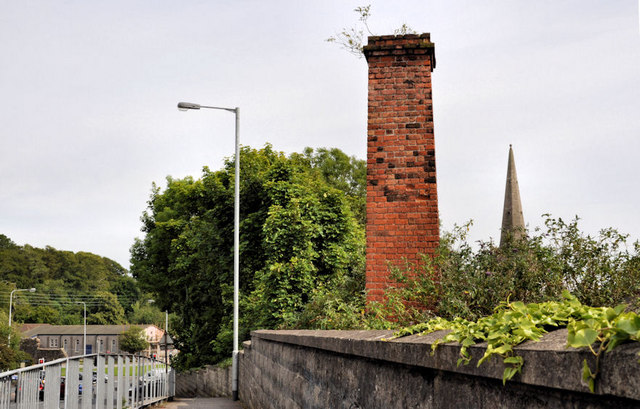
Old chimney, Bangor
This is the view, southeast, across the Boyne Bridge on the Brunswick Road. The railway J4981 : Approaching the Boyne Bridge, Bangor is below. Hard to imagine now but the Belfast and County Down railway had an extensive yard on the Belfast side. It included sidings, an engine shed and a sand drier of which this chimney was part. Dry sand was essential in preventing wheel slip. The old engine shed was (if my memory is correct) subsequently occupied by a business, making dog food, which later moved to Castlewellan. Continue to J5081 : Former engine shed, Bangor (1) (October 2013).
The Belfast and County Down Railway
The Belfast and County Down Railway ran from Queens Quay station in Belfast to Castlewellan via Comber, Downpatrick and Newcastle. There were also lines from Comber to Donaghadee via Newtownards, Belfast to Bangor and branches from Ballynahinch Jct to Ballynahinch and Downpatrick to Ardglass. The lines opened between 1848 and 1892. All closed by 1950 except for Castlewellan Newcastle which survived until 1955 as part of the GNR(I) route from Belfast via Banbridge and the Bangor line which remains open but from Belfast Central.
![Creative Commons Licence [Some Rights Reserved]](https://s1.geograph.org.uk/img/somerights20.gif)
|
· Find out How to reuse this image ·
Share:
|
|||||
| Start a discussion on J5081 | Suggest an update to this image | Contact the contributor | |||
Loading map... (JavaScript required)
- Grid Square
- J5081, 1044 images (more nearby
 )
)
- Photographer
- Albert Bridge (find more nearby)
- Date Taken
- Tuesday, 14 June, 2011 (more nearby)
- Submitted
- Wednesday, 15 June, 2011
- Geographical Context
- Subject Location
-
Irish:
 J 500 812 [100m precision]
WGS84: 54:39.4120N 5:40.5683W - Camera Location
-
Irish: J 500 812
- View Direction
- East-southeast (about 112 degrees)
Other Tags
Image classification(about):
Geograph
This page has been viewed about 796 times.
View this location:
KML (Google Earth) ·
Google Maps ·
Bing Maps ·
Geograph Coverage Map ·
More Links for this image
·
Bing Maps ·
Geograph Coverage Map ·
More Links for this image