SJ9599 : The Upper Lake, Stamford Park
taken 13 years ago, near to Hurst, Tameside, England
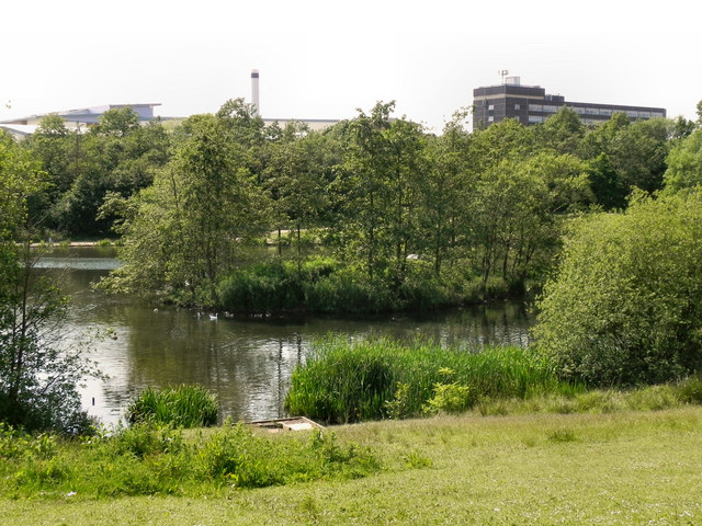
The reservoir was divided in two by an embankment, with the southern section becoming the present boating lake. This, the northern section, is used mostly for fishing by the Ridge Hill Angling Club.
Some of the buildings of Tameside Hospital can be seen behind the trees.
Stamford Park lies on the boundary between Ashton and Stalybridge. It was the first park to be opened in Ashton-under-Lyne.
Following a 17 year campaign by local cotton workers, Stamford Park was officially opened by Lord Stamford on the 12th July 1873. A crowd of 60-80,000 arrived on the day to watch the procession and opening ceremony.
Over the following two decades the park developed at pace, incorporating more land into the park. The former mill reservoir known as Chadwick Dams was incorporated into the park in 1891. The reservoir being divided in two by an embankment, with the southern section becoming the present boating lake.
The park now includes tennis courts, putting and bowling greens, a children's playground and paddling pool. The park also boasts an animal corner with a variety of birds and animals.
Linkphotos of Stamford Park in the 1960s
Link
Link
 Map © Crown Copyright")
- Grid Square
- SJ9599, 136 images (more nearby 🔍)
- Photographer
- David Dixon (more nearby)
- Date Taken
- Tuesday, 14 June, 2011 (more nearby)
- Submitted
- Wednesday, 15 June, 2011
- Subject Location
-
OSGB36:
 SJ 9566 9965 [10m precision]
WGS84: 53:29.6122N 2:4.0131W - Camera Location
-
OSGB36: SJ 9570 9966
- View Direction
- West-southwest (about 247 degrees)