J3673 : Foxglove Street, Belfast
taken 13 years ago, near to Belfast, Co Antrim, Northern Ireland
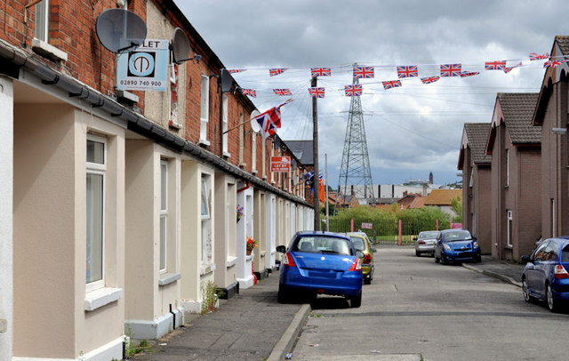
Foxglove Street, Belfast
A late 19th century street off the Beersbridge Road. One side retains the original terrace houses. The other has been redeveloped. Several streets, on this side of the road, have flowery names.
![Creative Commons Licence [Some Rights Reserved]](https://s1.geograph.org.uk/img/somerights20.gif)
|
· Find out How to reuse this image ·
Share:
|
|||||
| Start a discussion on J3673 | Suggest an update to this image | Contact the contributor | |||
Loading map... (JavaScript required)
- Grid Square
- J3673, 309 images (more nearby
 )
)
- Photographer
- Albert Bridge (find more nearby)
- Date Taken
- Friday, 15 July, 2011 (more nearby)
- Submitted
- Friday, 15 July, 2011
- Geographical Context
- Subject Location
-
Irish:
 J 361 735 [100m precision]
WGS84: 54:35.5160N 5:53.6299W - Camera Location
-
Irish: J 361 735
- View Direction
- Northeast (about 45 degrees)
Other Tags
Image classification(about):
Geograph
This page has been viewed about 169 times.
View this location:
KML (Google Earth) ·
Google Maps ·
Bing Maps ·
Geograph Coverage Map ·
More Links for this image
·
Bing Maps ·
Geograph Coverage Map ·
More Links for this image