2011
ST4939 : Dye House Lane Crossing
taken 13 years ago, near to Glastonbury, Somerset, England
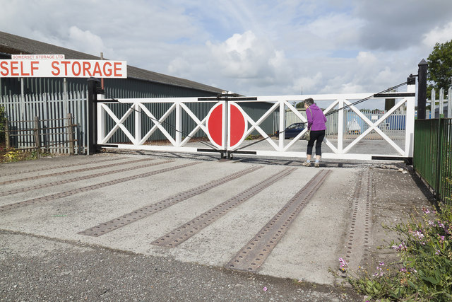
Dye House Lane Crossing
Although all trace of Glastonbury Station has vanished, a reminder of the railway's course is to be seen close to the A39 roundabout near the Glastonbury factory estate. The new bypass, in fact, uses the course of the old railway around the town.Here a new set of gates have been erected at the point where the track crossed Dye House Lane. The ironwork from the original trackbed is visible in the roadway.
 Map © Crown Copyright")
TIP: Click the map for more Large scale mapping
- Grid Square
- ST4939, 64 images (more nearby 🔍)
- Photographer
- Richard Bird (more nearby)
- Date Taken
- Sunday, 19 June, 2011 (more nearby)
- Submitted
- Sunday, 17 July, 2011
- Subject Location
-
OSGB36:
 ST 4929 3900 [10m precision]
WGS84: 51:8.8802N 2:43.5809W - Camera Location
-
OSGB36: ST 4931 3900
- View Direction
- WEST (about 270 degrees)