2011
TQ6841 : Tunbridge Wells Sandstone cliff, Horsmonden Rd
taken 13 years ago, near to Brenchley, Kent, England
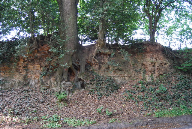
Tunbridge Wells Sandstone cliff, Horsmonden Rd
Tunbridge Wells sandstone is Lower Cretaceous in age. It was lain down in large braided river channels. Today it's outcrops form upland regions across the Weald of Kent. In the Tunbridge Wells area there are several locally famous sites. Mount Edgecumbe Rocks TQ5739 : Edgecumbe Rocks, Wellington Rocks TQ5739 : Wellington Rocks, Tunbridge Wells Common, Toad Rock TQ5639 : Toad Rock, Rusthall, Happy Valley Rocks TQ5639 : Happy Valley Rocks, High Rocks TQ5638 : High Rocks, Eridge Rocks TQ5535 : Eridge Rocks, The Chiddingstone TQ5045 : The Chiding stone, Chiddingstone, Harrison Rocks
The rock makes for good rock climbing in the SE of England.
The rock is locally rich in Iron and mining it gave the Wealden area an Iron making industry in Mediaevil times. It also accounts for a number of Chalybeate springs across Kent and Sussex.
See other images of Tunbridge Wells Sandstone
The rock makes for good rock climbing in the SE of England.
The rock is locally rich in Iron and mining it gave the Wealden area an Iron making industry in Mediaevil times. It also accounts for a number of Chalybeate springs across Kent and Sussex.
See other images of Tunbridge Wells Sandstone
 Map © Crown Copyright")
TIP: Click the map for more Large scale mapping
- Grid Square
- TQ6841, 275 images (more nearby 🔍)
- Photographer
- N Chadwick (more nearby)
- Date Taken
- Monday, 25 April, 2011 (more nearby)
- Submitted
- Thursday, 21 July, 2011
- Subject Location
-
OSGB36:
 TQ 6830 4112 [10m precision]
WGS84: 51:8.6763N 0:24.2796E - Camera Location
-
OSGB36: TQ 6831 4113
- View Direction
- South-southwest (about 202 degrees)