2000
TL1803 : Flooding on 30th October 2000 (3)
taken 23 years ago, near to London Colney, Hertfordshire, England
Flooding on 30th October 2000 (3)
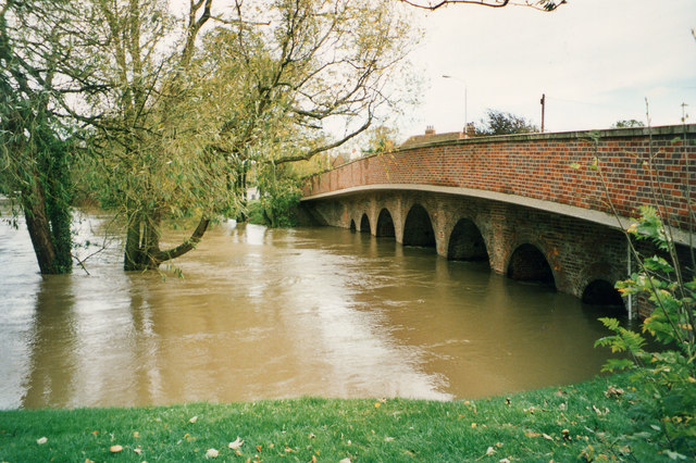
Upstream view of the bridge taken about 4pm shortly before the water reached its peak level - the depth gauge is just visible on the right of the picture and reads a water level of 65.75m (above sea level) - shortly after 4pm the peak of just over 65.9m was reached. In comparison the water level is usually around 64.3m, so the water was about 1.6m above normal (5ft 3inches). For a view of the bridge with normal water levels see TL1803 : Bridge over the River Colne, London Colney.
 Map © Crown Copyright")
TIP: Click the map for more Large scale mapping
- Grid Square
- TL1803, 131 images (more nearby 🔍)
- Photographer
- John Webb (more nearby)
- Date Taken
- Monday, 30 October, 2000 (more nearby)
- Submitted
- Monday, 8 August, 2011
- Subject Location
-
OSGB36:
 TL 1821 0368 [10m precision]
WGS84: 51:43.1638N 0:17.4097W - Camera Location
-
OSGB36: TL 1819 0370
- View Direction
- Southeast (about 135 degrees)