2011
SO6511 : Hewlett Way, Ruspidge
taken 13 years ago, near to Ruspidge, Gloucestershire, England
Hewlett Way, Ruspidge
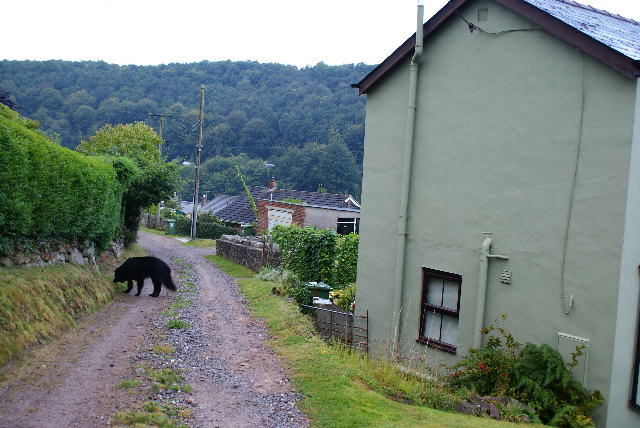
Looking down the unmettale portion of Hewlett Way, Ruspidge towards Grindles Lane, which is the local name for the hand-railed footpath connecting Buckshaft Road with Tramway Road.
 Map © Crown Copyright")
TIP: Click the map for more Large scale mapping
- Grid Square
- SO6511, 47 images (more nearby 🔍)
- Photographer
- Eric Soons (more nearby)
- Date Taken
- Monday, 22 August, 2011 (more nearby)
- Submitted
- Monday, 22 August, 2011
- Subject Location
-
OSGB36:
 SO 6510 1163 [10m precision]
WGS84: 51:48.1329N 2:30.4520W - Camera Location
-
OSGB36: SO 6512 1166
- View Direction
- South-southwest (about 202 degrees)