SU9230 : Sussex Border Path and Serpent Trail on Black Down
taken 13 years ago, 3 km from Kingsley Green, West Sussex, England
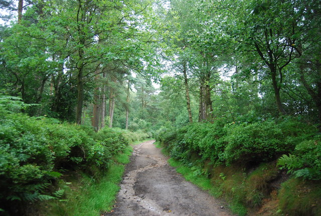
Blackdown, or Black Down, is the highest hill in Sussex, at 280 metres (919 feet), and is second only to Leith Hill (294 metres, 965 feet) in south-eastern England.
It is also the highest point in the South Downs National Park although it is located on the Greensand Ridge. The area is crossed by the Sussex Border Path and Serpent Trail. The pine and heather-covered slopes are owned by the National Trust, and are a favourite walking spot.
Wikipedia: Link
The Serpent Trail is a 64 mile long footpath. It runs from Haslemere to Petersfield by a winding route and is designed to join up many heathland areas on the greensand in the western Weald The path takes its name both from its serpentine shape and from passing through the habitat of all three British species of snake. The logo is a serpent see SU8931 : Logo for the Serpent Trail
Website: Link
The Sussex Border Path is a footpath route nearly 150 miles long around the inland boundary of the county of Sussex. The county owes its origins to the kingdom of the South Saxons and can claim to have one of the longest inland county boundaries from Emsworth to Rye. The route was devised in 1983 and is well signed along most of the route. Website Link
Map: Link
 Map © Crown Copyright")
- Grid Square
- SU9230, 69 images (more nearby 🔍)
- Photographer
- N Chadwick (more nearby)
- Date Taken
- Saturday, 9 July, 2011 (more nearby)
- Submitted
- Friday, 2 September, 2011
- Subject Location
-
OSGB36:
 SU 9207 3048 [10m precision]
WGS84: 51:3.9768N 0:41.2447W - Camera Location
-
OSGB36: SU 9206 3046
- View Direction
- North-northeast (about 22 degrees)