2009
SX6958 : Footpath by the Glaze Brook
taken 15 years ago, near to South Brent, Devon, England
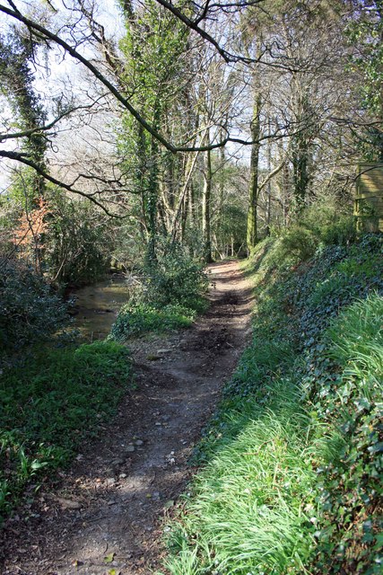
Footpath by the Glaze Brook
The bridleway proper runs along the Glaze Brook on the left SX6958 : The Glaze Brook, but this path allows pedestrians to traverse the bridleway with dry feet. It leads to the clam bridge SX6958 : Clam bridge over the Glaze Brook. Thankfully it cannot be used by horses which would damage the surface.
 Map © Crown Copyright")
TIP: Click the map for more Large scale mapping
- Grid Square
- SX6958, 38 images (more nearby 🔍)
- Photographer
- Adrian Platt (more nearby)
- Date Taken
- Tuesday, 17 March, 2009 (more nearby)
- Submitted
- Saturday, 3 September, 2011
- Subject Location
-
OSGB36:
 SX 69114 58983 [1m precision]
WGS84: 50:24.9654N 3:50.6169W - Camera Location
-
OSGB36: SX 69114 58983
- View Direction
- NORTH (about 0 degrees)