2011
NF0999 : Main Street, Hirta
taken 13 years ago, near to Mullach Sgar [hill or Mountain], Na h-Eileanan an Iar, Great Britain
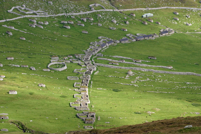
Main Street, Hirta
Hirta is the main island of the St Kilda archipelago and was inhabited for, probably, 2,000 years before the population was finally evacuated in 1930. The traditional stone blackhouse were built in 1830s and later replaced c.1860, after a great storm, by sixteen new cottages. The remains of the blackhouses continued to be used as animal byres and for storage. Six of the cottages have been renovated for use by the National Trust for Scotland.
The wall running around the village is the head dyke which was to keep grazing animals out of the cultivated areas. The round enclosure left of centre is the village graveyard.
The wall running around the village is the head dyke which was to keep grazing animals out of the cultivated areas. The round enclosure left of centre is the village graveyard.
 Map © Crown Copyright")
TIP: Click the map for more Large scale mapping
- Grid Square
- NF0999, 56 images (more nearby 🔍)
- Photographer
- Phil Thirkell (more nearby)
- Date Taken
- Monday, 5 September, 2011 (more nearby)
- Submitted
- Tuesday, 13 September, 2011
- Subject Location
-
OSGB36:
 NF 0991 9930 [10m precision]
WGS84: 57:48.7508N 8:34.3757W - Camera Location
-
OSGB36: NF 0925 9902
- View Direction
- East-northeast (about 67 degrees)