J5945 : The Machicolation of Kilclief Castle
taken 13 years ago, 4 km N of Ballyhornan, Co Down, Northern Ireland
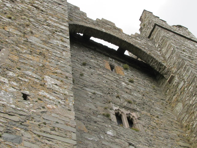
The Machicolation of Kilclief Castle
A machicolation is a floor opening between the supporting corbels of a battlement, through which all manner of nasty things could be, and were, dropped on unwanted visitors.
![Creative Commons Licence [Some Rights Reserved]](https://s1.geograph.org.uk/img/somerights20.gif)
|
· Find out How to reuse this image ·
Share:
|
|||||
| Start a discussion on J5945 | Suggest an update to this image | Contact the contributor | |||
Loading map... (JavaScript required)
- Grid Square
- J5945, 62 images (more nearby
 )
)
- Photographer
- Eric Jones (find more nearby)
- Date Taken
- Tuesday, 20 September, 2011 (more nearby)
- Submitted
- Tuesday, 27 September, 2011
- Geographical Context
- Subject Location
-
Irish:
 J 597 457 [100m precision]
WGS84: 54:20.1278N 5:32.7184W - Camera Location
-
Irish: J 597 457
- View Direction
- Northwest (about 315 degrees)
Image classification(about):
Supplemental image
This page has been viewed about 260 times.
View this location:
KML (Google Earth) ·
Google Maps ·
Bing Maps ·
Geograph Coverage Map ·
More Links for this image
·
Bing Maps ·
Geograph Coverage Map ·
More Links for this image