2011
NS9568 : Earthwork at Lower Bathville
taken 13 years ago, near to Armadale, West Lothian, Scotland
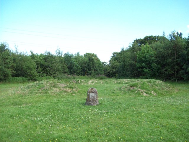
Earthwork at Lower Bathville
The small standing stone was erected by the Boy Scouts during some kind of Millennium celebration, but I haven't been able to find out anything about the horseshoe-shaped earthwork.
It definitely pre-dates the local housing estate, because it can be seen in aerial photographs taken before the houses were built. Somebody who has lived nearby for sixteen years told me it was there when he moved in. It doesn't seem to be a marker on top of a septic tank and it's too low and too small to be a sheep-fold, yet it's not marked on the OS map as an ancient monument either. Some kind of Victorian folly, possibly?
It definitely pre-dates the local housing estate, because it can be seen in aerial photographs taken before the houses were built. Somebody who has lived nearby for sixteen years told me it was there when he moved in. It doesn't seem to be a marker on top of a septic tank and it's too low and too small to be a sheep-fold, yet it's not marked on the OS map as an ancient monument either. Some kind of Victorian folly, possibly?
 Map © Crown Copyright")
TIP: Click the map for more Large scale mapping
- Grid Square
- NS9568, 16 images (more nearby 🔍)
- Photographer
- Claire M Jordan (more nearby)
- Date Taken
- Wednesday, 13 July, 2011 (more nearby)
- Submitted
- Sunday, 2 October, 2011
- Subject Location
-
OSGB36:
 NS 9511 6829 [10m precision]
WGS84: 55:53.7761N 3:40.7352W - Camera Location
-
OSGB36: NS 9503 6831
- View Direction
- East-southeast (about 112 degrees)