2011
NT9952 : Berwick Bridge
taken 13 years ago, near to Tweedmouth, Northumberland, England
This is 1 of 35 images, with title Berwick Bridge in this square
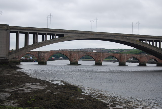
Berwick Bridge
The present bridge dates from 1624 and is the fourth to have stood on this location. Two of the previous structures were destroyed by flooding and one by an English attack. The bridge is 355 metres long and was the original route of the A1, before the construction of the Royal Tweed Bridge in the 1920s. The bridge is a Grade I listed structure. Link
See other images of Berwick Bridge
See other images of Berwick Bridge
 Map © Crown Copyright")
TIP: Click the map for more Large scale mapping
- Grid Square
- NT9952, 1400 images (more nearby 🔍)
- Photographer
- N Chadwick (more nearby)
- Date Taken
- Wednesday, 1 June, 2011 (more nearby)
- Submitted
- Saturday, 8 October, 2011
- Subject Location
-
OSGB36:
 NT 9962 5273 [10m precision]
WGS84: 55:46.0747N 2:0.4575W - Camera Location
-
OSGB36: NT 9957 5299
- View Direction
- SOUTH (about 180 degrees)