J0154 : The Bann Bridge, Portadown (2)
taken 12 years ago, near to Portadown, Co Armagh, Northern Ireland
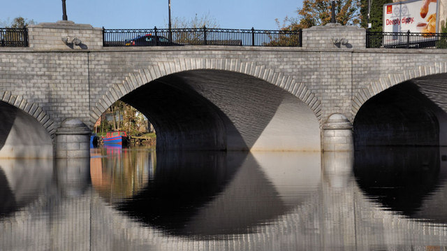
The Bann Bridge, Portadown (2)
See J0153 : Flooding, Portadown (3). Despite the residual flooding in the Bann Meadows, the Bann had returned to its normal tranquillity as it passed, downstream, under the Bann Bridge J0154 : The Bann Bridge, Portadown. See also J0154 : Flooding at the River Bann Bridge, Portadown.
![Creative Commons Licence [Some Rights Reserved]](https://s1.geograph.org.uk/img/somerights20.gif)
|
· Find out How to reuse this image ·
Share:
|
|||||
| Start a discussion on J0154 | Suggest an update to this image | Contact the contributor | |||
Loading map... (JavaScript required)
- Grid Square
- J0154, 131 images (more nearby
 )
)
- Photographer
- Albert Bridge (find more nearby)
- Date Taken
- Friday, 4 November, 2011 (more nearby)
- Submitted
- Friday, 4 November, 2011
- Geographical Context
- Subject Location
-
Irish:
 J 013 540 [100m precision]
WGS84: 54:25.5162N 6:26.3360W - Camera Location
-
Irish: J 013 540
- View Direction
- NORTH (about 0 degrees)
Other Tags
Image classification(about):
Geograph
This page has been viewed about 220 times.
View this location:
KML (Google Earth) ·
Google Maps ·
Bing Maps ·
Geograph Coverage Map ·
More Links for this image
·
Bing Maps ·
Geograph Coverage Map ·
More Links for this image