2011
SD8069 : Dry Rig Quarry
taken 13 years ago, near to Helwith Bridge, North Yorkshire, England
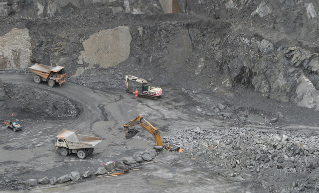
Dry Rig Quarry
After blast, loading broken silurian slate to go to crusher.
Shipped out for road stone.
Shipped out for road stone.
 Map © Crown Copyright")
TIP: Click the map for more Large scale mapping
- Grid Square
- SD8069, 73 images (more nearby 🔍)
- Photographer
- Dennis Shevelan (more nearby)
- Date Taken
- Tuesday, 31 May, 2011 (more nearby)
- Submitted
- Saturday, 5 November, 2011
- Subject Location
-
OSGB36:
 SD 8000 6968 [10m precision]
WGS84: 54:7.3553N 2:18.4499W - Camera Location
-
OSGB36: SD 8005 6973
- View Direction
- Southwest (about 225 degrees)