J3574 : Regeneration site, east Belfast
taken 12 years ago, near to Belfast, Co Antrim, Northern Ireland
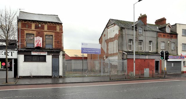
Regeneration site, east Belfast
Over the last 25 (or so) years the private sector invested considerable amounts of money on prestige city centre J3374 : The Castle Court shopping centre, Belfast, Laganside J3474 : Laganside buildings, Belfast, Titanic Quarter J3474 : The Abercorn Basin, Belfast (26) and on suburban residential developments J3874 : Pembridge Court, Belfast. While there was public expenditure on new housing J3574 : Glenallen Street, Belfast and J3674 : Recent housing, east Belfast (1) many of the buildings fronting the Albertbridge and Newtownards Roads have fallen into a woeful state.
This site, between Carnforth and Templemore Streets, off the former, has been acquired by the Department for Social Development as a regeneration site. Another one The Skainos Project Link , on the Newtownards Road, is under construction.
This site, between Carnforth and Templemore Streets, off the former, has been acquired by the Department for Social Development as a regeneration site. Another one The Skainos Project Link
Belfast regeneration sites
Sites acquired by the Department for Social Development (DSD) which manages a regeneration strategy for the renewal and development of the most deprived areas in and around Belfast.
The photographs submitted by me appear as a matter of historical and geographical record only. I have no connection with the DSD, any community group or property developer.
![Creative Commons Licence [Some Rights Reserved]](https://s1.geograph.org.uk/img/somerights20.gif)
|
· Find out How to reuse this image ·
Share:
|
|||||
| Start a discussion on J3574 | Suggest an update to this image | Contact the contributor | |||
Loading map... (JavaScript required)
- Grid Square
- J3574, 516 images (more nearby
 )
)
- Photographer
- Albert Bridge (find more nearby)
- Date Taken
- Tuesday, 8 November, 2011 (more nearby)
- Submitted
- Tuesday, 8 November, 2011
- Geographical Context
- Subject Location
-
Irish:
 J 359 740 [100m precision]
WGS84: 54:35.7843N 5:53.8667W - Camera Location
-
Irish: J 359 740
- View Direction
- South-southwest (about 202 degrees)
Other Tags
Image classification(about):
Geograph
This page has been viewed about 126 times.
View this location:
KML (Google Earth) ·
Google Maps ·
Bing Maps ·
Geograph Coverage Map ·
More Links for this image