2004
TL4133 : Scales Park
taken 19 years ago, near to Anstey, Hertfordshire, England
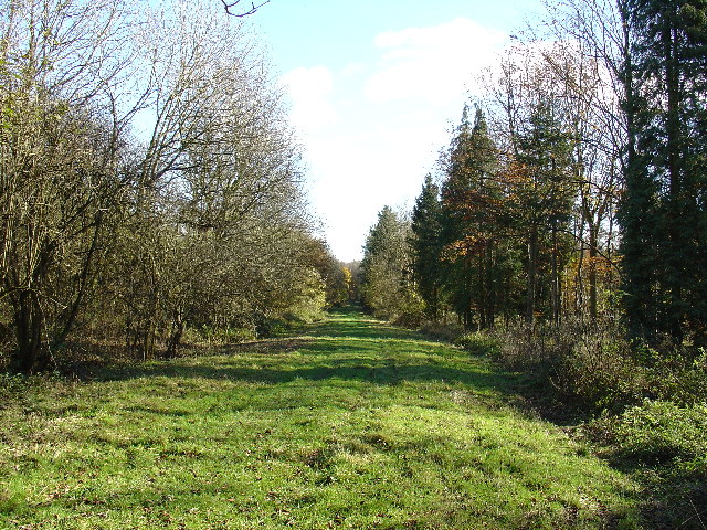
Scales Park
View along one of the access roads that run through what remains of Scales Park. The majority of the trees were felled to create the US Airforce Station 131 during the Second World War.
 Map © Crown Copyright")
TIP: Click the map for more Large scale mapping
- Grid Square
- TL4133, 14 images (more nearby 🔍)
- Photographer
- Simon Judd (more nearby)
- Date Taken
- Tuesday, 16 November, 2004 (more nearby)
- Submitted
- Wednesday, 13 July, 2005
- Subject Location
-
OSGB36:
 TL 41 33 [1000m precision]
WGS84: 51:58.9168N 0:3.5383E