H0137 : The N16 at Brockagh Lower
taken 13 years ago, near to Glenfarne, Co Leitrim, Ireland
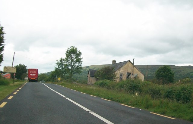
The N16 at Brockagh Lower
The old building on the right is the former Brockagh National School. It dates back to 1885.
![Creative Commons Licence [Some Rights Reserved]](https://s1.geograph.org.uk/img/somerights20.gif)
|
· Find out How to reuse this image ·
Share:
|
|||||
| Start a discussion on H0137 | Suggest an update to this image | Contact the contributor | |||
Loading map... (JavaScript required)
- Grid Square
- H0137, 10 images (more nearby
 )
)
- Photographer
- Eric Jones (find more nearby)
- Date Taken
- Monday, 27 June, 2011 (more nearby)
- Submitted
- Saturday, 12 November, 2011
- Geographical Context
- Subject Location
-
Irish:
 H 014 372 [100m precision]
WGS84: 54:17.0555N 7:58.7550W - Camera Location
-
Irish: H 014 372
- View Direction
- Northwest (about 315 degrees)
Image classification(about):
Geograph
This page has been viewed about 48 times.
View this location:
KML (Google Earth) ·
Google Maps ·
Bing Maps ·
Geograph Coverage Map ·
More Links for this image
·
Bing Maps ·
Geograph Coverage Map ·
More Links for this image