C8432 : The "Burhou.I" at Coleraine
taken 12 years ago, near to Coleraine, Co Londonderry, Northern Ireland
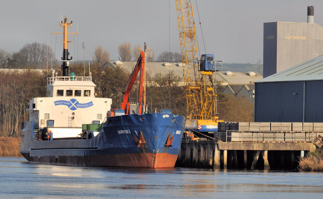
The "Burhou.I" at Coleraine
The coaster Burhou.I loading building materials probably for the west of Scotland.
Ships on the River Bann
A collection of photographs of ships which have visited the River Bann and Coleraine.
![Creative Commons Licence [Some Rights Reserved]](https://s1.geograph.org.uk/img/somerights20.gif)
|
· Find out How to reuse this image ·
Share:
|
|||||
| Start a discussion on C8432 | Suggest an update to this image | Contact the contributor | |||
Loading map... (JavaScript required)
- Grid Square
- C8432, 388 images (more nearby
 )
)
- Photographer
- Albert Bridge (find more nearby)
- Date Taken
- Monday, 14 November, 2011 (more nearby)
- Submitted
- Monday, 14 November, 2011
- Geographical Context
- Subject Location
-
Irish:
 C 846 327 [100m precision]
WGS84: 55:8.0675N 6:40.4124W - Camera Location
-
Irish: C 845 326
- View Direction
- Northeast (about 45 degrees)
Other Tags
Image classification(about):
Geograph
This page has been viewed about 132 times.
View this location:
KML (Google Earth) ·
Google Maps ·
Bing Maps ·
Geograph Coverage Map ·
More Links for this image
·
Bing Maps ·
Geograph Coverage Map ·
More Links for this image