2012
SU6081 : Close up of Cleeve Bridge benchmark
taken 12 years ago, near to Goring, Oxfordshire, England
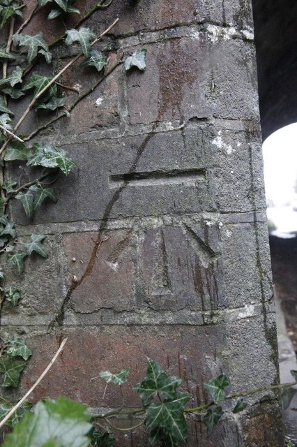
Close up of Cleeve Bridge benchmark
Closer view of the benchmark on Cleeve Bridge near Goring. SU6081 : Benchmark on Cleeve Bridge
 Map © Crown Copyright")
TIP: Click the map for more Large scale mapping
- Grid Square
- SU6081, 42 images (more nearby 🔍)
- Photographer
- Bill Nicholls (more nearby)
- Date Taken
- Sunday, 1 January, 2012 (more nearby)
- Submitted
- Wednesday, 4 January, 2012
- Subject Location
-
OSGB36:
 SU 6016 8149 [10m precision]
WGS84: 51:31.7475N 1:8.0495W - Camera Location
-
OSGB36: SU 6016 8149
- View Direction
- East-northeast (about 67 degrees)