2003
TL4657 : View of Rustat Ave taken 21/6/2003
taken 21 years ago, near to Cambridge, Cambridgeshire, England
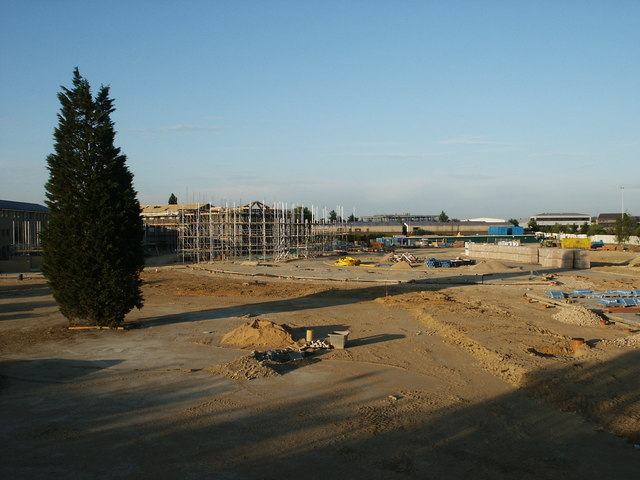
View of Rustat Ave taken 21/6/2003
View of Rustat Ave after Cambridge Instruments factory was demolished, but before houses were erected.
 Map © Crown Copyright")
TIP: Click the map for more Large scale mapping
- Grid Square
- TL4657, 2304 images (more nearby 🔍)
- Photographer
- chris hayes (more nearby)
- Date Taken
- Saturday, 21 June, 2003 (more nearby)
- Submitted
- Sunday, 22 January, 2012
- Subject Location
-
OSGB36:
 TL 4638 5732 [10m precision]
WGS84: 52:11.6814N 0:8.4116E - Camera Location
-
OSGB36: TL 4643 5741
- View Direction
- South-southwest (about 202 degrees)