J3574 : The Templemore Hall, Belfast
taken 12 years ago, near to Belfast, Co Antrim, Northern Ireland
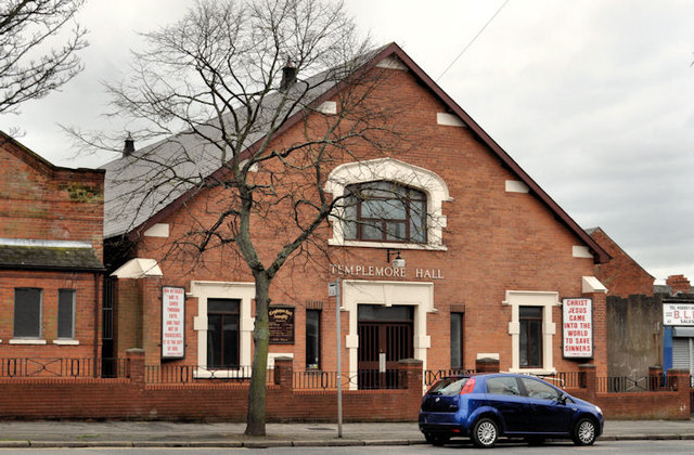
The Templemore Hall, Belfast
Gospel hall in Templemore Avenue, opposite Keatley Street. The 1901 street directory shows vacant ground. The 1907 edition discloses a mission hall at no 131.
Gospel halls, Northern Ireland
A collection of photographs showing some of the gospel and mission halls in Northern Ireland.
Templemore Avenue, Belfast
A long street running from the Castlereagh Road/Beersbridge Road, across the Albertbridge Road to the Newtownards Road It developed over a number of years from the late 19th century. In 1880 it had only three houses.
![Creative Commons Licence [Some Rights Reserved]](https://s1.geograph.org.uk/img/somerights20.gif)
|
· Find out How to reuse this image ·
Share:
|
|||||
| Start a discussion on J3574 | Suggest an update to this image | Contact the contributor | |||
Loading map... (JavaScript required)
- Grid Square
- J3574, 516 images (more nearby
 )
)
- Photographer
- Albert Bridge (find more nearby)
- Date Taken
- Wednesday, 25 January, 2012 (more nearby)
- Submitted
- Wednesday, 25 January, 2012
- Geographical Context
- Subject Location
-
Irish:
 J 356 740 [100m precision]
WGS84: 54:35.7996N 5:54.1259W - Camera Location
-
Irish: J 356 740
- View Direction
- WEST (about 270 degrees)
Other Tags
Image classification(about):
Geograph
This page has been viewed about 997 times.
View this location:
KML (Google Earth) ·
Google Maps ·
Bing Maps ·
Geograph Coverage Map ·
More Links for this image
·
Bing Maps ·
Geograph Coverage Map ·
More Links for this image