J4568 : Lane near Comber (5)
taken 12 years ago, near to Comber, Co Down, Northern Ireland
Lane near Comber (5)
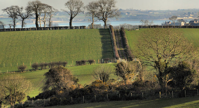
See J4567 : Lane near Comber (4). The same lane, climbing the side of a drumlin, seen from a higher viewpoint, further south west along the Old Ballygowan Road J4467 : The Old Ballygowan Road near Comber. Strangford Lough is in the background.
![Creative Commons Licence [Some Rights Reserved]](https://s1.geograph.org.uk/img/somerights20.gif)
|
· Find out How to reuse this image ·
Share:
|
|||||
| Start a discussion on J4568 | Suggest an update to this image | Contact the contributor | |||
Loading map... (JavaScript required)
- Grid Square
- J4568, 34 images (more nearby
 )
)
- Photographer
- Albert Bridge (find more nearby)
- Date Taken
- Friday, 3 February, 2012 (more nearby)
- Submitted
- Friday, 3 February, 2012
- Geographical Context
- Subject Location
-
Irish:
 J 454 681 [100m precision]
WGS84: 54:32.4634N 5:45.1733W - Camera Location
-
Irish: J 448 675
- View Direction
- Northeast (about 45 degrees)
Other Tags
Image classification(about):
Supplemental image
This page has been viewed about 39 times.
View this location:
KML (Google Earth) ·
Google Maps ·
Bing Maps ·
Geograph Coverage Map ·
More Links for this image
·
Bing Maps ·
Geograph Coverage Map ·
More Links for this image