J5073 : The Floodgates car park, Newtownards
taken 12 years ago, near to Newtownards, Co Down, Northern Ireland
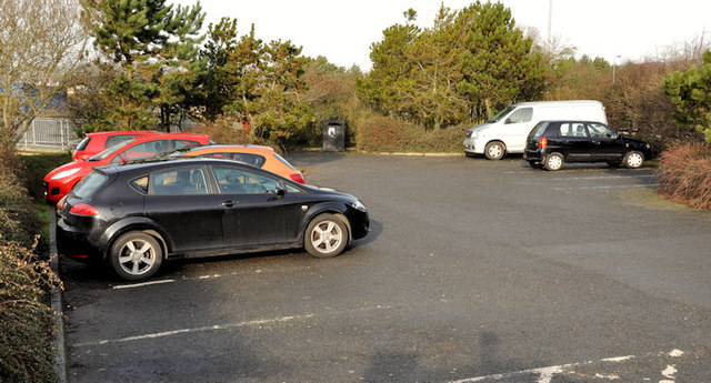
The Floodgates car park, Newtownards
This small car park, on the Portaferry Road, is provided for users of the path along the seawall J4972 : Sea defences, Newtownards (2), at the northern end of Strangford Lough. What makes it a bit different is that, despite its size, it has three litter bins and one doggy bin. The tern floodgates is explained in J5073 : "The Floodgates" bus stop, Newtownards.
![Creative Commons Licence [Some Rights Reserved]](https://s1.geograph.org.uk/img/somerights20.gif)
|
· Find out How to reuse this image ·
Share:
|
|||||
| Start a discussion on J5073 | Suggest an update to this image | Contact the contributor | |||
Loading map... (JavaScript required)
- Grid Square
- J5073, 28 images (more nearby
 )
)
- Photographer
- Albert Bridge (find more nearby)
- Date Taken
- Tuesday, 7 February, 2012 (more nearby)
- Submitted
- Tuesday, 7 February, 2012
- Geographical Context
- Subject Location
-
Irish:
 J 501 730 [100m precision]
WGS84: 54:35.0050N 5:40.7265W - Camera Location
-
Irish: J 501 730
- View Direction
- West-northwest (about 292 degrees)
Other Tags
Image classification(about):
Geograph
This page has been viewed about 452 times.
View this location:
KML (Google Earth) ·
Google Maps ·
Bing Maps ·
Geograph Coverage Map ·
More Links for this image
·
Bing Maps ·
Geograph Coverage Map ·
More Links for this image