2012
SU1217 : Benchmark on the bridge
taken 12 years ago, near to Rockbourne, Hampshire, England
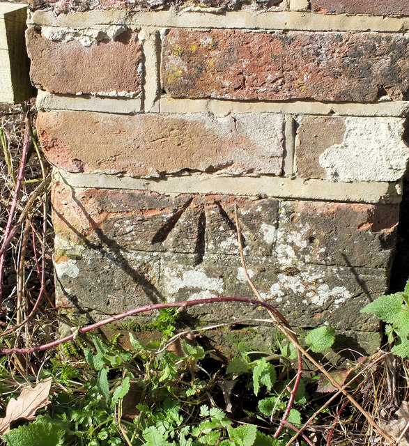
Benchmark on the bridge
The Ordnance Survey cut mark can be found on the north-west parapet of the bridge seen in SU1217 : Crossing Sweatfords Water, the datum line seems to have been lost during rebuilding work above the arrow. For more information visit Link
 Map © Crown Copyright")
TIP: Click the map for more Large scale mapping
- Grid Square
- SU1217, 27 images (more nearby 🔍)
- Photographer
- Jonathan Kington (more nearby)
- Date Taken
- Monday, 5 March, 2012 (more nearby)
- Submitted
- Monday, 5 March, 2012
- Subject Location
-
OSGB36:
 SU 1209 1710 [10m precision]
WGS84: 50:57.1924N 1:49.7552W - Camera Location
-
OSGB36: SU 1209 1710
- View Direction
- Northwest (about 315 degrees)