2006
SD8985 : Ridge Head Hill, Marsett, Raydale
taken 17 years ago, near to Marsett, North Yorkshire, England
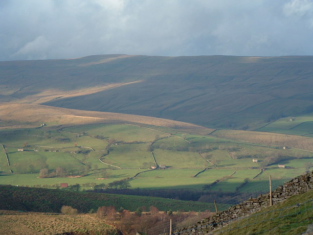
Ridge Head Hill, Marsett, Raydale
Ridge Head Hill (middle ground of photo) is an area of boggy fell to the SW of Marsett. A road running to Raydale along the valley bottom has numerous small farms with the characteristic dales dry-stone walls around the fields and field barns. Wether Fell above Hawes is seen in the distance.
 Map © Crown Copyright")
TIP: Click the map for more Large scale mapping
- Grid Square
- SD8985, 6 images (more nearby 🔍)
- Photographer
- Geoff Keeble (more nearby)
- Date Taken
- Wednesday, 29 November, 2006 (more nearby)
- Submitted
- Wednesday, 29 November, 2006
- Subject Location
-
OSGB36:
 SD 89 85 [1000m precision]
WGS84: 54:15.9031N 2:9.7624W - View Direction
- WEST (about 270 degrees)