2012
TA4213 : Groynes and remains of fishing nets
taken 12 years ago, 3 km from Kilnsea, East Riding of Yorkshire, England
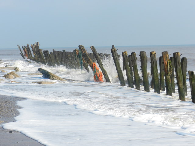
Groynes and remains of fishing nets
On the beach nearing Spurn Point.
 Map © Crown Copyright")
TIP: Click the map for more Large scale mapping
- Grid Square
- TA4213, 136 images (more nearby 🔍)
- Photographer
- Peter Barr (more nearby)
- Date Taken
- Friday, 30 March, 2012 (more nearby)
- Submitted
- Sunday, 1 April, 2012
- Subject Location
-
OSGB36:
 TA 4228 1390 [10m precision]
WGS84: 53:36.1411N 0:8.9247E - Camera Location
-
OSGB36: TA 4226 1384
- View Direction
- North-northeast (about 22 degrees)