2012
NF9383 : Beinn Shleibhe Path
taken 12 years ago, near to Ruisgarry, North Uist & Berneray, Na h-Eileanan an Iar, Scotland
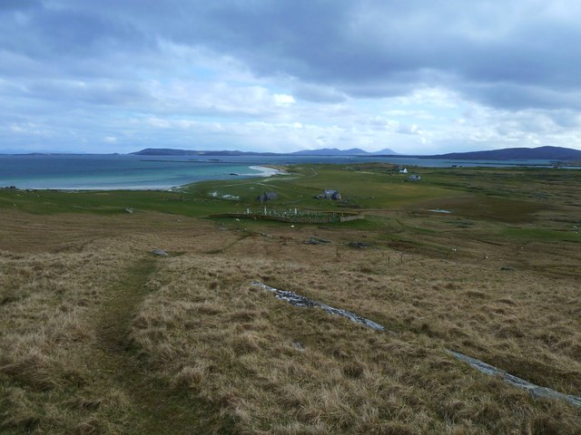
Beinn Shleibhe Path
A waymarked path leads down from the hill towards the Burial Ground.
 Map © Crown Copyright")
TIP: Click the map for more Large scale mapping
- Grid Square
- NF9383, 13 images (more nearby 🔍)
- Photographer
- Graham Hewitt (more nearby)
- Date Taken
- Saturday, 14 April, 2012 (more nearby)
- Submitted
- Wednesday, 18 April, 2012
- Subject Location
-
OSGB36:
 NF 9327 8302 [10m precision]
WGS84: 57:43.9059N 7:9.3154W - Camera Location
-
OSGB36: NF 9325 8304
- View Direction
- Southeast (about 135 degrees)