2011
SX8570 : Tower of St Mary's Church Wolborough
taken 13 years ago, near to Newton Abbot, Devon, England
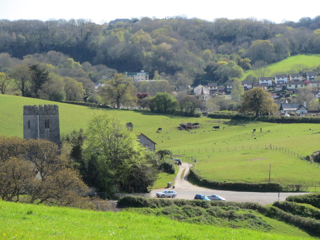
Tower of St Mary's Church Wolborough
Across this shallow valley, on the right of the photo, lies the new development of houses of East Ogwell. To the left and hidden in the trees in the distance lies the disused Conitor Limestone Quarry
Today the lower section of the old quarry is used as an industrial estate, the rest of the old quarry is a little overgrown but the limestone rock faces are still visible. SX8569 : Conitor Limestone Quarry - near East Ogwell SX8569 : Conitor Limestone Quarry - near East Ogwell
On the road alongside the quarry is an old lime kiln.
 Map © Crown Copyright")
TIP: Click the map for more Large scale mapping
- Grid Square
- SX8570, 213 images (more nearby 🔍)
- Photographer
- Colin Vosper (more nearby)
- Date Taken
- Wednesday, 27 April, 2011 (more nearby)
- Submitted
- Saturday, 28 April, 2012
- Subject Location
-
OSGB36:
 SX 8545 7038 [10m precision]
WGS84: 50:31.3175N 3:37.0366W - Camera Location
-
OSGB36: SX 8557 7064
- View Direction
- South-southwest (about 202 degrees)