2006
SU4437 : Field boundary/track north of Sutton Down Farm
taken 17 years ago, 3 km from Sutton Scotney, Hampshire, England
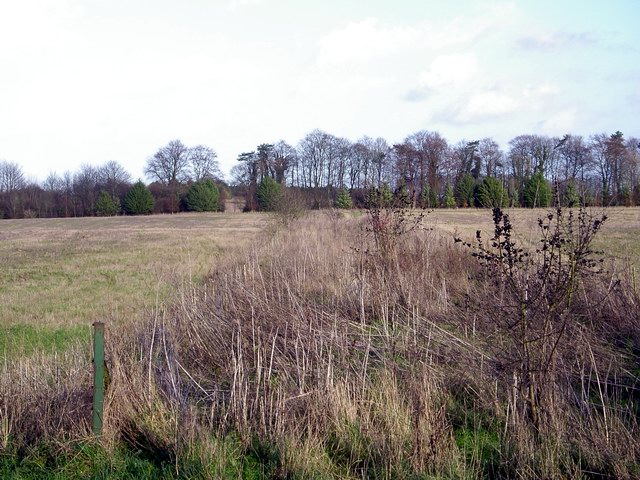
Field boundary/track north of Sutton Down Farm
What seems to be an overgrown track serves as a field boundary. Where the trees in the distance intersect with the boundary is also the northern edge of the grid square.
 Map © Crown Copyright")
TIP: Click the map for more Large scale mapping
- Grid Square
- SU4437, 6 images (more nearby 🔍)
- Photographer
- Peter Jordan (more nearby)
- Date Taken
- Sunday, 3 December, 2006 (more nearby)
- Submitted
- Friday, 15 December, 2006
- Subject Location
-
OSGB36:
 SU 443 378 [100m precision]
WGS84: 51:8.2658N 1:22.0914W - Camera Location
-
OSGB36: SU 442 377
- View Direction
- Northeast (about 45 degrees)