J1040 : Bisected drumlin near Loughbrickland
taken 12 years ago, 5 km ENE of Poyntz Pass, Co Armagh, Northern Ireland
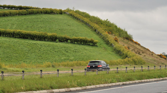
Bisected drumlin near Loughbrickland
A drumlin, on the southern side of Loughbrickland, bisected by the building of the dual carriageway J1041 : Belfast - Dublin road near Loughbrickland (2). The Google map uses blue to show the road although its not a motorway.
Drumlin country
In simple (non-technical) words, drumlins are rounded hills, usually of stones and clays deposited by glaciers during the ice age. They form the basket of eggs landscape found in parts of Cos Down and Armagh.
![Creative Commons Licence [Some Rights Reserved]](https://s1.geograph.org.uk/img/somerights20.gif)
|
· Find out How to reuse this image ·
Share:
|
|||||
| Start a discussion on J1040 | Suggest an update to this image | Contact the contributor | |||
Loading map... (JavaScript required)
- Grid Square
- J1040, 7 images (more nearby
 )
)
- Photographer
- Albert Bridge (find more nearby)
- Date Taken
- Saturday, 19 May, 2012 (more nearby)
- Submitted
- Saturday, 19 May, 2012
- Geographical Context
- Subject Location
-
Irish:
 J 108 406 [100m precision]
WGS84: 54:18.1616N 6:17.8486W - Camera Location
-
Irish: J 109 404
- View Direction
- North-northwest (about 337 degrees)
Other Tags
Image classification(about):
Geograph
This page has been viewed about 71 times.
View this location:
KML (Google Earth) ·
Google Maps ·
Bing Maps ·
Geograph Coverage Map ·
More Links for this image
·
Bing Maps ·
Geograph Coverage Map ·
More Links for this image