J3472 : The southern end of Jerusalem Street. in Belfast's Holy Land
taken 12 years ago, near to Belfast, Co Antrim, Northern Ireland
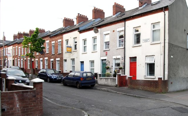
The southern end of Jerusalem Street. in Belfast's Holy Land
Jerusalem Street and its neighbouring streets, Carmel, Palastine, Damascus and Cairo, form part of the Belfast Holy Land District. The houses are sub let to students.
Link
Link
![Creative Commons Licence [Some Rights Reserved]](https://s1.geograph.org.uk/img/somerights20.gif)
|
· Find out How to reuse this image ·
Share:
|
|||||
| Start a discussion on J3472 | Suggest an update to this image | Contact the contributor | |||
Loading map... (JavaScript required)
- Grid Square
- J3472, 419 images (more nearby
 )
)
- Photographer
- Eric Jones (find more nearby)
- Date Taken
- Saturday, 19 May, 2012 (more nearby)
- Submitted
- Saturday, 26 May, 2012
- Geographical Context
- Subject Location
-
Irish:
 J 341 724 [100m precision]
WGS84: 54:34.9611N 5:55.5241W - Camera Location
-
Irish: J 341 724
- View Direction
- North-northeast (about 22 degrees)
Image classification(about):
Geograph
This page has been viewed about 35 times.
View this location:
KML (Google Earth) ·
Google Maps ·
Bing Maps ·
Geograph Coverage Map ·
More Links for this image