2012
TQ0347 : Where the rail went
taken 12 years ago, near to Chilworth, Surrey, England
Where the rail went
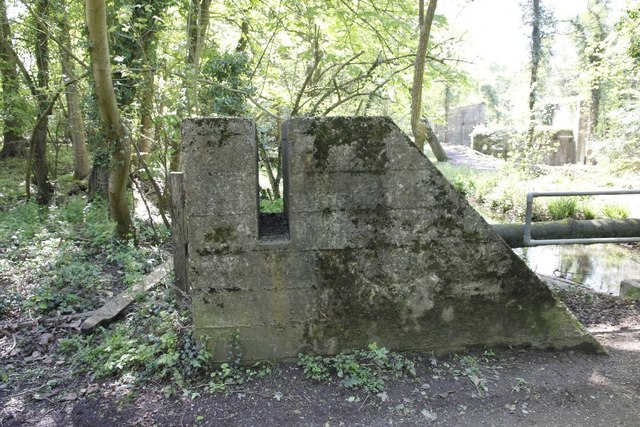
This is the first of this type of road block I have seen which I think is a rail block, the slot is where the rails were placed to block the road. It would have had a mate opposite but it's been removed.
 Map © Crown Copyright")
TIP: Click the map for more Large scale mapping
- Grid Square
- TQ0347, 191 images (more nearby 🔍)
- Photographer
- Bill Nicholls (more nearby)
- Date Taken
- Saturday, 12 May, 2012 (more nearby)
- Submitted
- Tuesday, 29 May, 2012
- Subject Location
-
OSGB36:
 TQ 0330 4765 [10m precision]
WGS84: 51:13.1228N 0:31.3367W - Camera Location
-
OSGB36: TQ 0330 4765
- View Direction
- South-southwest (about 202 degrees)