D3307 : The Feystown Road at Linford near Cairncastle
taken 17 years ago, near to Carncastle, Co Antrim, Northern Ireland
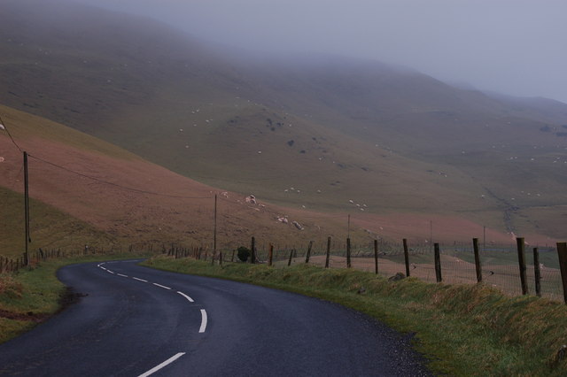
The Feystown Road at Linford near Cairncastle
Much of the land to the west and north west of Larne is moorland suitable mainly for sheep and forestry. Here it is just over 900ft and the Feystown Road is making its twisting way towards Cairncastle. The low cloud was doing its best to produce a light mizzle.
![Creative Commons Licence [Some Rights Reserved]](https://s1.geograph.org.uk/img/somerights20.gif)
|
· Find out How to reuse this image ·
Share:
|
|||||
| Start a discussion on D3307 | Suggest an update to this image | Contact the contributor | |||
Loading map... (JavaScript required)
- Grid Square
- D3307, 13 images (more nearby
 )
)
- Photographer
- Albert Bridge (find more nearby)
- Date Taken
- Friday, 22 December, 2006 (more nearby)
- Submitted
- Friday, 22 December, 2006
- Category
- Road > Road (more nearby)
- Subject Location
-
Irish:
 D 33 07 [1000m precision]
WGS84: 54:53.8398N 5:55.1911W - View Direction
- Northeast (about 45 degrees)
This page has been viewed about 339 times.
View this location:
KML (Google Earth) ·
Google Maps ·
Bing Maps ·
Geograph Coverage Map ·
More Links for this image
·
Bing Maps ·
Geograph Coverage Map ·
More Links for this image