2006
SE3739 : Railway Embankment
taken 18 years ago, near to Thorner, Leeds, England
This is 1 of 2 images, with title starting with Railway in this square
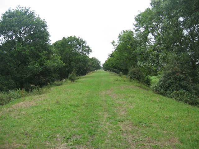
Railway Embankment
The old path of the railway which ran north from here into Thorner. This is now a public footpath which runs from Thorner south, over the A64 and all the way to Barwick In Elmet.
 Map © Crown Copyright")
TIP: Click the map for more Large scale mapping
- Grid Square
- SE3739, 35 images (more nearby 🔍)
- Photographer
- Chris McLean (more nearby)
- Date Taken
- Sunday, 20 August, 2006 (more nearby)
- Submitted
- Saturday, 23 December, 2006
- Subject Location
-
OSGB36:
 SE 37 39 [1000m precision]
WGS84: 53:51.0233N 1:25.8872W - View Direction
- SOUTH (about 180 degrees)