2003
SH6527 : Bwlch Drws-Ardudwy
taken 21 years ago, near to Rhinog Fach [hill or Mountain], Gwynedd, Great Britain
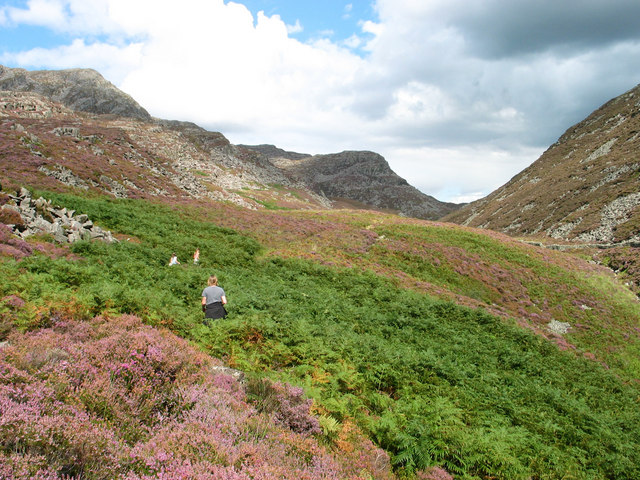
Bwlch Drws-Ardudwy
The path along Cwm Nantcol to Bwlch Drws-Ardudwy can be easily reached from the end of the road near Maes-y-garnedd SH6426 where there is parking for about half a dozen cars (and a small fee payable at the farmhouse honesty box). Progress to the col that separates Rhinog Fawr from Rhinog Fach is steady but offers a taster of the deep heather-clad bouldery terrain to come.
 Map © Crown Copyright")
TIP: Click the map for more Large scale mapping
- Grid Square
- SH6527, 17 images (more nearby 🔍)
- Photographer
- Ian Nadin (more nearby)
- Date Taken
- Saturday, 30 August, 2003 (more nearby)
- Submitted
- Monday, 25 December, 2006
- Subject Location
-
OSGB36:
 SH 653 276 [100m precision]
WGS84: 52:49.7424N 4:0.0447W - Camera Location
-
OSGB36: SH 652 276
- View Direction
- Northeast (about 45 degrees)