B7122 : Owey Island harbour
taken 12 years ago, 5 km NNW of Kincaslough, Co Donegal, Ireland
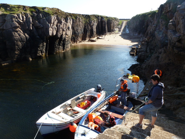
Owey Island harbour
One of three harbours, this one is on the eastern shore, just a ten minute boat ride from Cruit.
![Creative Commons Licence [Some Rights Reserved]](https://s1.geograph.org.uk/img/somerights20.gif)
|
· Find out How to reuse this image ·
Share:
|
|||||
| Start a discussion on B7122 | Suggest an update to this image | Contact the contributor | |||
Loading map... (JavaScript required)
- Grid Square
- B7122, 13 images (more nearby
 )
)
- Photographer
- louise price (find more nearby)
- Date Taken
- Sunday, 10 June, 2012 (more nearby)
- Submitted
- Sunday, 10 June, 2012
- Geographical Context
- Subject Location
-
Irish:
 B 719 229 [100m precision]
WGS84: 55:3.1824N 8:26.3783W - Camera Location
-
Irish: B 719 229
- View Direction
- South-southwest (about 202 degrees)
This page has been viewed about 125 times.
View this location:
KML (Google Earth) ·
Google Maps ·
Bing Maps ·
Geograph Coverage Map ·
More Links for this image
·
Bing Maps ·
Geograph Coverage Map ·
More Links for this image