R3377 : Ennis - Abbey Street - Friary Ruins
taken 12 years ago, near to Ennis, Co Clare, Ireland
This is 1 of 2 images, with title Ennis - Abbey Street - Friary Ruins in this square
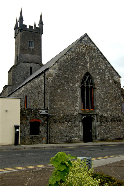
Ennis - Abbey Street - Friary Ruins
View is from south side of Club Bridge and east side of Abbey Street.
![Creative Commons Licence [Some Rights Reserved]](https://s1.geograph.org.uk/img/somerights20.gif)
|
· Find out How to reuse this image ·
Share:
|
|||||
| Start a discussion on R3377 | Suggest an update to this image | Contact the contributor | |||
Loading map... (JavaScript required)
- Grid Square
- R3377, 566 images (more nearby
 )
)
- Photographer
- Joseph Mischyshyn (find more nearby)
- Date Taken
- Thursday, 17 May, 2012 (more nearby)
- Submitted
- Tuesday, 3 July, 2012
- Geographical Context
- Subject Location
-
Irish:
 R 339 776 [100m precision]
WGS84: 52:50.7590N 8:58.9065W - Camera Location
-
Irish: R 338 776
- View Direction
- Southeast (about 135 degrees)
Image classification(about):
Geograph
This page has been viewed about 35 times.
View this location:
KML (Google Earth) ·
Google Maps ·
Bing Maps ·
Geograph Coverage Map ·
More Links for this image
·
Bing Maps ·
Geograph Coverage Map ·
More Links for this image