2006
SD8291 : Mossdale Head. Wensleydale
taken 17 years ago, near to Cotterdale, North Yorkshire, England
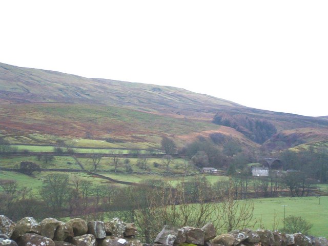
Mossdale Head. Wensleydale
Mossdale Head is at the western end of Mossdale, one of the smallest dales of Wensleydale and really not much more than a widening of the main valley. The most prominent features of the grid square are the two waterfalls in the wooded valley on the right (western end) of the photo. Note the railway viaduct arches of the Wensleydale Railway which closed in 1956.
 Map © Crown Copyright")
TIP: Click the map for more Large scale mapping
- Grid Square
- SD8291, 25 images (more nearby 🔍)
- Photographer
- Geoff Keeble (more nearby)
- Date Taken
- Sunday, 31 December, 2006 (more nearby)
- Submitted
- Sunday, 31 December, 2006
- Subject Location
-
OSGB36:
 SD 825 916 [100m precision]
WGS84: 54:19.1808N 2:16.2321W - Camera Location
-
OSGB36: SD 829 922
- View Direction
- South-southwest (about 202 degrees)