2007
SS7619 : Ford between Meshaw Village and Parsonage farm
taken 17 years ago, near to Meshaw, Devon, England
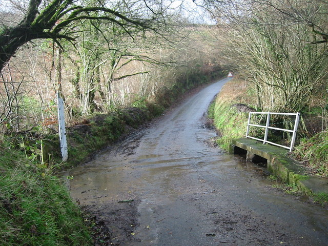
Ford between Meshaw Village and Parsonage farm
The lane drops steeply from the main road and this small stream crosses in the dip. The post to measure the depth of water is shown in the photo and signs warn the road is liable to flooding.
 Map © Crown Copyright")
TIP: Click the map for more Large scale mapping
- Grid Square
- SS7619, 21 images (more nearby 🔍)
- Photographer
- Jenny Aker (more nearby)
- Date Taken
- Monday, 1 January, 2007 (more nearby)
- Submitted
- Monday, 1 January, 2007
- Subject Location
-
OSGB36:
 SS 764 196 [100m precision]
WGS84: 50:57.7516N 3:45.6845W - View Direction
- Southwest (about 225 degrees)