M2925 : Galway - River Corrib Walk
taken 12 years ago, near to Salthill, Co Galway, Ireland
Galway - River Corrib Walk
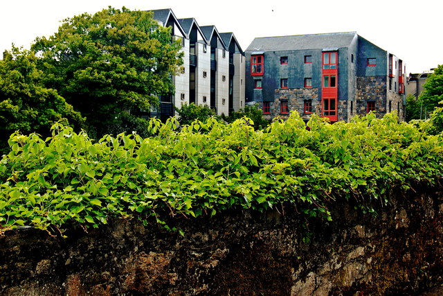
Galway is also known as Baile na Struthan (Town of Streams), as a major portion of the River Corrib experiences a significant drop in elevation at the Salmon Weir, but smaller portions are channelled away above the Salmon Weir in various directions. To the east, one smaller portion is channelled through one or more small canal(s) along the east of the River Corrib and the River Corrib Walk, whereby that portion undergoes a series of elevation drops via small dams. To the southwest, a larger portion of the River Corrib is channelled into the Eglington Canal and around three islands (St Nicholas Cathedral, Nun's Island, and an island southwest of Nun's Island) that experience different elevation drops via two or more dams. Eventually, seven streams converge back together near O'Briens Bridge and Wolfe Tone Bridge. This is best seen on the free Galway City Tourist Map available at a Tourist Office near Eyre Square. I find this most interesting and have done the Corrib River Walk each time I've visited Galway. There is also a Canal Walk that I haven't done yet. The buildings shown are located along the west bank of the River Corrib between O'Brien's Bridge and Wolfe Tone Bridge. The view is from Jury's Inn area.
![Creative Commons Licence [Some Rights Reserved]](https://s1.geograph.org.uk/img/somerights20.gif)
|
· Find out How to reuse this image ·
Share:
|
|||||
| Start a discussion on M2925 | Suggest an update to this image | Contact the contributor | |||
Loading map... (JavaScript required)
- Grid Square
- M2925, 470 images (more nearby
 )
)
- Photographer
- Joseph Mischyshyn (find more nearby)
- Date Taken
- Friday, 18 May, 2012 (more nearby)
- Submitted
- Sunday, 8 July, 2012
- Geographical Context
- Subject Location
-
Irish:
 M 295 250 [100m precision]
WGS84: 53:16.2601N 9:3.3830W - Camera Location
-
Irish: M 296 249
- View Direction
- Northwest (about 315 degrees)
Image classification(about):
Geograph
This page has been viewed about 155 times.
View this location:
KML (Google Earth) ·
Google Maps ·
Bing Maps ·
Geograph Coverage Map ·
More Links for this image
·
Bing Maps ·
Geograph Coverage Map ·
More Links for this image