R4560 : Bunratty Park - Site #5 - Mountain Farmhouse
taken 12 years ago, near to Bunratty, Co Clare, Ireland
This is 1 of 3 images, with title Bunratty Park - Site #5 - Mountain Farmhouse in this square
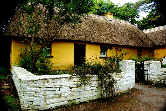
Bunratty Park - Site #5 - Mountain Farmhouse
A poor farmer's house, with a loft for additional sleeping space, found on the borders of Limerick & Kerry.
![Creative Commons Licence [Some Rights Reserved]](https://s1.geograph.org.uk/img/somerights20.gif)
|
· Find out How to reuse this image ·
Share:
|
|||||
| Start a discussion on R4560 | Suggest an update to this image | Contact the contributor | |||
Loading map... (JavaScript required)
- Grid Square
- R4560, 238 images (more nearby
 )
)
- Photographer
- Joseph Mischyshyn (find more nearby)
- Date Taken
- Sunday, 20 May, 2012 (more nearby)
- Submitted
- Friday, 20 July, 2012
- Geographical Context
- Subject Location
-
Irish:
 R 451 609 [100m precision]
WGS84: 52:41.8424N 8:48.7486W - Camera Location
-
Irish: R 451 609
- View Direction
- West-northwest (about 292 degrees)
Image classification(about):
Geograph
This page has been viewed about 18 times.
View this location:
KML (Google Earth) ·
Google Maps ·
Bing Maps ·
Geograph Coverage Map ·
More Links for this image
·
Bing Maps ·
Geograph Coverage Map ·
More Links for this image