J3527 : Slieve Donard Triangulation Pillar
taken 12 years ago, 5 km SSW of Newcastle, Co Down, Northern Ireland
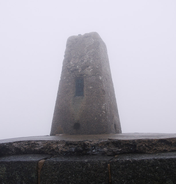
The re-triangulation of Northern Ireland by the Ordnance Survey Northern Ireland began in 1950. This was the first complete survey of Northern Ireland which included observations with the new primary triangulation of the country, its connection with the Republic of Ireland and the cross-channel connection between Ireland and Great Britain. This began by OSNI establishing a series of triangulation stations throughout the country. Almost all of these stations were topped by trig pillars and 80, mainly primary and secondary pillars, had been constructed by October 1949. Measurements between primary stations began in 1950 and measurements for these and the secondary stations were completed by July 1956. The construction and measurements for tertiary stations were completed later (probably no later than the mid 1960s). Only two stations are not topped by pillars - Lighthouse Island, marked by a brass rivet, and Ardglass, which utilised the top of a high stone folly. The older triangulation stations on the Lough Foyle Base Line were also re-surveyed as part of this process. A majority of the stations are still extant today but a few have been removed or destroyed.
The Mourne Wall is a 22 mile long wall in the Mourne Mountains. It was built between 1904 and 1922 by the Belfast Water Commissioners to enclose their catchment areas in the Mournes and protect the area from the effects of cattle and sheep on the water course Link
. The wall is predominately constructed from local granite using traditional dry stone walling techniques; on average the wall is about 1.5 metres high and 0.8 to 0.9 metres thick. It is not uniform in construction along the entire length - the 'classic' granite wall is only to be found north of Carn mountain and Long Seefin with particularly impressive sections on Slieve Commedagh and Slieve Donard; elsewhere it largely resembles the traditional dry stone walls found elsewhere in the Mournes and south County Down. In places, such as Slieve Muck, the wall is not constructed of granite at all.
![Creative Commons Licence [Some Rights Reserved]](https://s1.geograph.org.uk/img/somerights20.gif)
|
· Find out How to reuse this image ·
Share:
|
|||||
| Start a discussion on J3527 | Suggest an update to this image | Contact the contributor | |||
- Grid Square
- J3527, 100 images (more nearby
 )
)
- Photographer
- Rossographer (find more nearby)
- Date Taken
- Saturday, 11 August, 2012 (more nearby)
- Submitted
- Monday, 13 August, 2012
- Geographical Context
- Place (from Tags)
- Subject Location
-
Irish:
 J 35787 27685 [1m precision]
WGS84: 54:10.8121N 5:55.2596W - Camera Location
-
Irish: J 35787 27685
- View Direction
- Northeast (about 45 degrees)
Other Tags