NS2577 : Greenock Navy Buildings
taken 12 years ago, near to Larkfield, Inverclyde, Scotland
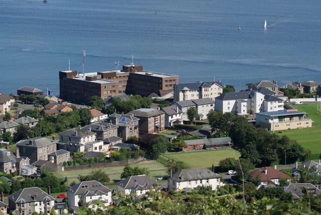
2016 update: The buildings were demolished in 2015 NS2577 : Site of Greenock Navy Buildings.
Named after Abram Lyle of the Tate & Lyle sugar company, who was Provost of Greenock when the road was built in 1878. The following extract is from the 1907 book "GREENOCK STREET NAMES - THEIR HISTORY AND ROMANCE, by Gardner Blair, which is reproduced in its entirety on the Inverclyde Council web site at Link
----------
"The Lyle Road was formed in the year 1878, during a period of business depression, following on the failure of the City of Glasgow Bank. This event caused much distress in the West of Scotland, and paralysed trade for years afterwards.
In those days Provost Abram Lyle occupied the chair of civic chief, and it is interesting to note that the idea of having a road round the Bingans originated in the mind of his good lady. The streets were full of idle men willing to work, but unable to find anything to which they might turn their hands. Provost Lyle was much exercised in his mind regarding this unhappy state of affairs, and often talked of the matter in his home. During one of these conversations, Mrs. Lyle exclaimed, Why not put the unemployed to the making of a drive round the Bingans? And there we have the origin of this popular promenade.
The cost of the road amounted to £16,482 12s 4d, and there is no doubt whatever that it provided necessary labour for decent artizans, while the town acquired at a moderate cost a really splendid boulevard."
----------
The outstanding views from the top of Lyle Road make the effort of the climb worthwhile.
The road climbs around 400 feet over its one mile length, making it popular with cyclists who hold hill climbs there annually. The record for the climb is three minutes and thirty seven seconds, by former Scottish Commonwealth Games rider Sandy Gilchrist in the Scottish Championship event which was organised by Greenock Road Club in 1983.
 Map © Crown Copyright")
- Grid Square
- NS2577, 363 images (more nearby 🔍)
- Photographer
- Thomas Nugent (more nearby)
- Date Taken
- Wednesday, 8 August, 2012 (more nearby)
- Submitted
- Thursday, 23 August, 2012
- Subject Location
-
OSGB36:
 NS 2576 7764 [10m precision]
WGS84: 55:57.6045N 4:47.5667W - Camera Location
-
OSGB36: NS 2563 7715
- View Direction
- North-northeast (about 22 degrees)