2012
TM1033 : South-east area of Brantham Industrial Estate
taken 12 years ago, near to Cattawade, Suffolk, England
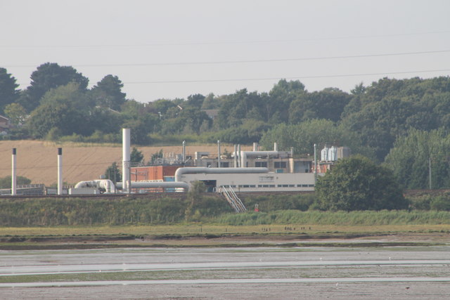
South-east area of Brantham Industrial Estate
The Brantham Industrial Area is situated in the south of the Babergh district and has been established and used for industrial purposes since the late 19th century. This image is as seen from Hopping Bridge at Mistley and shows what good planning can achieve in four years. (Just love those long lenses on a clear day - 75 to 300mm seems perfect.)
 Map © Crown Copyright")
TIP: Click the map for more Large scale mapping
- Grid Square
- TM1033, 47 images (more nearby 🔍)
- Photographer
- Tony Peacock (more nearby)
- Date Taken
- Sunday, 19 August, 2012 (more nearby)
- Submitted
- Thursday, 23 August, 2012
- Subject Location
-
OSGB36:
 TM 109 330 [100m precision]
WGS84: 51:57.3373N 1:4.1525E - Camera Location
-
OSGB36: TM 113 320
- View Direction
- North-northwest (about 337 degrees)