2012
SO7876 : Dowles Churchyard
taken 12 years ago, near to Wribbenhall, Worcestershire, England
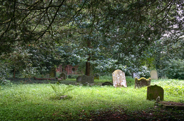
Dowles Churchyard
The church of St Andrew was demolished in 1956 and now there remains only a fragment of brick wall in the churchyard. There had been a church here since 1217 when it was confirmed at Great Malvern priory. By 1931 the church had fallen into disuse.
 Map © Crown Copyright")
TIP: Click the map for more Large scale mapping
- Grid Square
- SO7876, 77 images (more nearby 🔍)
- Photographer
- Morturn (more nearby)
- Date Taken
- Saturday, 25 August, 2012 (more nearby)
- Submitted
- Sunday, 26 August, 2012
- Subject Location
-
OSGB36:
 SO 780 762 [100m precision]
WGS84: 52:23.0085N 2:19.4789W - Camera Location
-
OSGB36: SO 780 762
- View Direction
- Southwest (about 225 degrees)