2007
NO6681 : Thorter Hill
taken 17 years ago, 3 km from Glensaugh, Aberdeenshire, Scotland
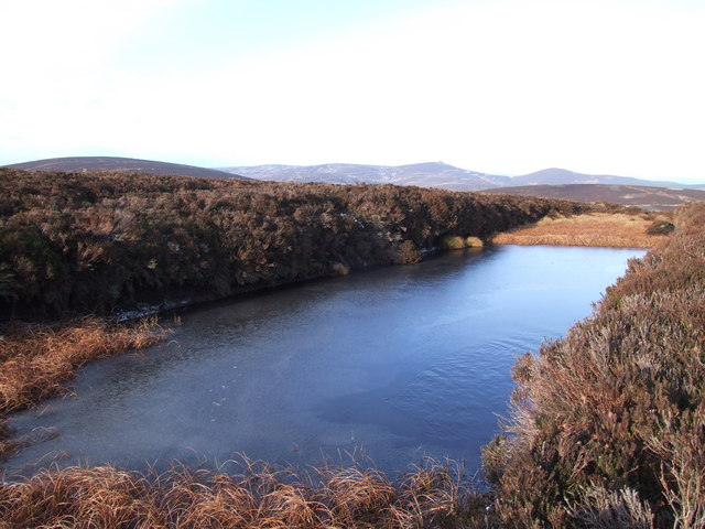
Thorter Hill
This frozen over pond lies N.W from the top of the hill
looking towards the distant Clachnaben and Mount Shade
looking towards the distant Clachnaben and Mount Shade
 Map © Crown Copyright")
TIP: Click the map for more Large scale mapping
- Grid Square
- NO6681 (more nearby 🔍)
- Photographer
- Alan Thomson (more nearby)
- Date Taken
- Sunday, 14 January, 2007 (more nearby)
- Submitted
- Sunday, 14 January, 2007
- Subject Location
-
OSGB36:
 NO 66 81 [1000m precision]
WGS84: 56:55.4151N 2:33.1166W - View Direction
- North-northwest (about 337 degrees)