J3629 : The extraction pipeline at Craignagore Bridge
taken 12 years ago, 3 km from Newcastle, Co Down, Northern Ireland
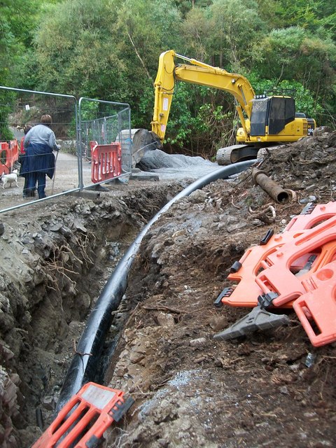
The extraction pipeline at Craignagore Bridge
Water for the Newcastle HEP Scheme, estimated at 90% of its flow, will be extracted from the Glen River just above the bridge and carried underground to the turbine house at Shimna All Children's Integrated Primary School.
Link
Link
![Creative Commons Licence [Some Rights Reserved]](https://s1.geograph.org.uk/img/somerights20.gif)
|
· Find out How to reuse this image ·
Share:
|
|||||
| Start a discussion on J3629 | Suggest an update to this image | Contact the contributor | |||
Loading map... (JavaScript required)
- Grid Square
- J3629, 301 images (more nearby
 )
)
- Photographer
- Eric Jones (find more nearby)
- Date Taken
- Sunday, 23 September, 2012 (more nearby)
- Submitted
- Sunday, 23 September, 2012
- Geographical Context
- Subject Location
-
Irish:
 J 369 299 [100m precision]
WGS84: 54:11.9872N 5:54.1588W - Camera Location
-
Irish: J 369 299
- View Direction
- Southwest (about 225 degrees)
Image classification(about):
Geograph
This page has been viewed about 42 times.
View this location:
KML (Google Earth) ·
Google Maps ·
Bing Maps ·
Geograph Coverage Map ·
More Links for this image